
Drone mapping

For usable survey data and digital models

With drone mapping, we map sites, construction sites and large project areas quickly and accurately. We capture detailed aerial images and process them into usable geodata, such as orthophotos, 3D point clouds, digital terrain models and volume calculations.

So you don’t just get images from the air, but measurable data you can use for design, planning, execution and monitoring.

What is drone mapping?

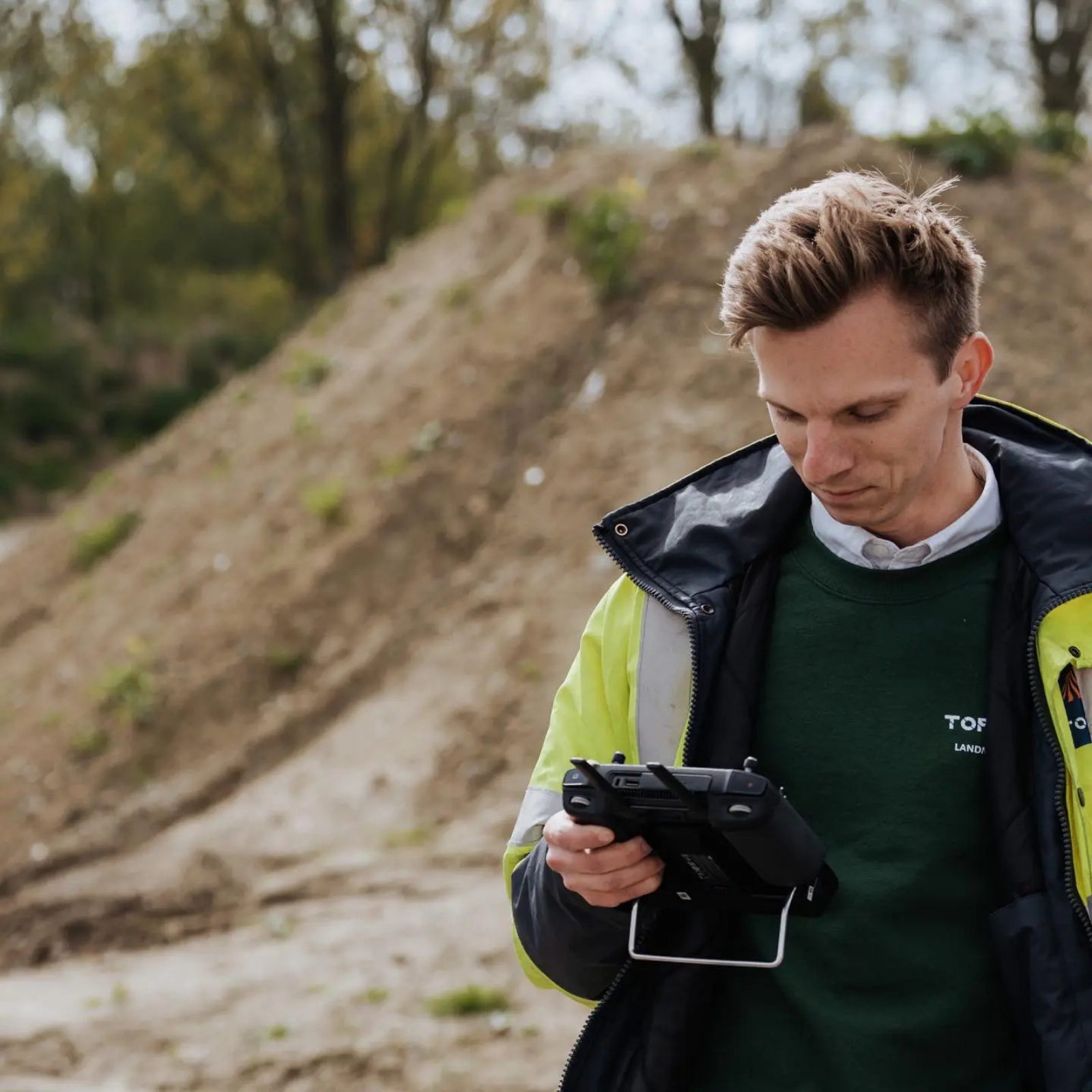
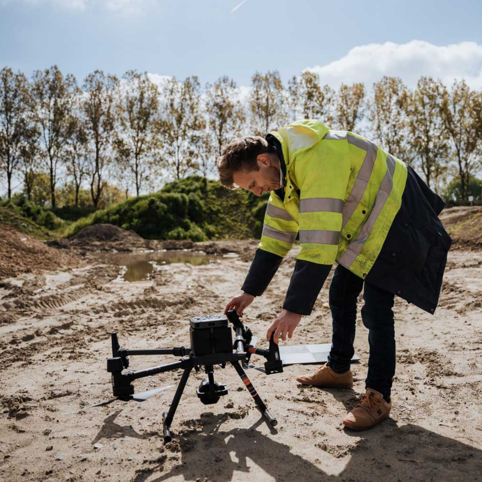
Landmeter van TOPO4D bereidt een drone voor op een werf voor drone mapping.

What is drone mapping used for?

Drone mapping can be used in different phases of a project. It is particularly useful when you need a complete and up-to-date view of a site or construction site quickly.

  • Land surveys: capturing large sites quickly and in detail as a basis for analysis and design. For riverbeds and water bodies, this can be supplemented with bathymetry.
  • Construction and infrastructure: mapping the existing situation for design preparation, inspections and technical documentation.
  • Construction site monitoring: comparing different survey moments to track progress and changes. Continuous follow-up is possible through monitoring.
  • Earthworks and volume calculations: accurately calculating volumes of excavations, fills, soil heaps and other materials.
  • Industrial sites: efficiently recording and documenting large sites, storage areas and complex terrain.
  • Hard-to-reach locations: safely mapping zones from the air. For targeted checks, a drone inspection can also be carried out.

What does drone mapping deliver?

Orthophoto

An orthophoto is a geometrically corrected aerial photo on which distances and areas can be measured to scale. It provides an up-to-date and clear basis for plans, analyses and further project development.

3D point cloud

Digital terrain model (DTM)

A digital terrain model digitally represents the shape and height differences of the terrain. It is used to analyse height differences, create profiles and prepare earthworks accurately.

Digital surface model (DSM)

A digital surface model records both the terrain and the objects above it. Think of buildings, vegetation, installations and other elements that are part of the existing situation.

Contour lines and survey files

Based on the drone mapping, elevation data, contour lines and other survey files can be generated. These form a useful basis for further processing in design, study and execution work.

Volume calculations

Drone mapping makes it possible to accurately calculate volumes of soil, sand, excavations, fills and stockpiles. By comparing survey moments, the evolution of volumes can also be monitored easily.

Planning a drone survey?

Tell us what you need: an orthophoto, a terrain model or a complete point cloud. Together we look at which survey and file format best suit your project.

Surveying with a drone: how does it work?

01

Analysis

We look at exactly what needs to be mapped, how large the project area is and what the data will be used for afterwards. Based on this, we determine the required level of detail, the survey method and the most suitable approach.

02

Preparation

Before the drone takes off, we analyse the location and the flight environment. We draw up a suitable flight plan and determine, among other things, the flight altitude, image overlap and any reference points.

03

Data

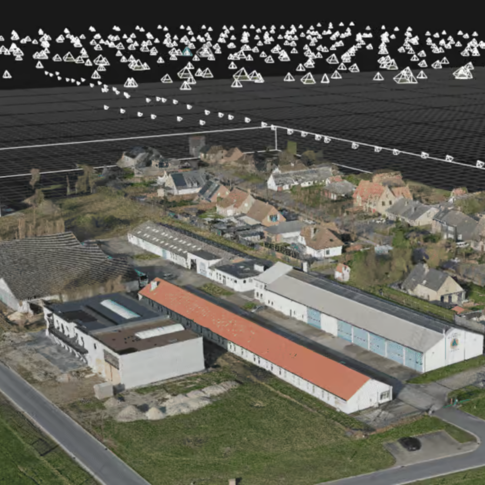
The drone flies over the site in a systematic pattern and captures a large number of overlapping aerial images. This way, the entire project area is recorded efficiently and in detail.

04

Processing

The collected images are processed with specialised software. Using photogrammetry, corresponding points in the images are recognised and combined into a georeferenced, measurable dataset.

05

Delivery

After quality control, we process the data into the agreed output. This can be an orthophoto, 3D point cloud, digital terrain model, surface model or volume calculation, ready for further processing in CAD, GIS or other software.

Some of our projects

Why choose drone mapping?

A traditional land survey and a drone survey each have their own applications. For large or complex areas, drone mapping offers several advantages:

  • Large areas mapped quickly: a drone collects a lot of survey data over an entire project area in a short time.
  • Lots of data in one survey: the entire visible environment is recorded digitally, so you can still extract information from the dataset afterwards.
  • Capturing the current situation: ideal for baseline surveys, construction site monitoring and comparing different phases of a project.
  • Safe surveying: hard-to-reach or high-risk zones can be recorded from the air without unnecessary risks on the ground.
  • Ready for further processing: the collected data can be used in CAD and GIS environments, among others.
3D-model van een terrein met camerastandpunten uit een drone mapping.

This is why clients choose TOPO4D

One single point of contact

You work with one partner throughout the entire process. This keeps communication, planning and follow-up clear, from the first survey to the final delivery.

Land surveying expertise

We combine drone technology with land surveying knowledge. This way, the collected data is not only processed, but also correctly interpreted and verified.

Tailored
output

No standard export, but survey data tailored to your project. We take into account the intended application, workflow and further processing.

Ready to use

You receive files that fit your design, study, costing or construction site process, so you can move forward without unnecessary intermediate steps.

They went before you

Peter De Schrijver
"Ik ben ontzettend tevreden over de diensten van TOPO 4D en zaakvoerder Guillaume Vanden Avenne. Guillaume maakt altijd correcte afspraken en komt deze ook stipt na. De prijzen zijn zeer correct en transparant, zonder verrassingen achteraf. Zijn kennis en expertise in het vak zijn indrukwekkend; hij is echt een krak in zijn vakgebied. Bovendien is hij altijd op de hoogte van de nieuwste methodes en technieken. Ik kan TOPO 4D van harte aanbevelen aan iedereen die een betrouwbare en deskundige landmeter zoekt!"
Jonas Van Vaerenbergh
"Zeer goed landmeetkantoor die up-to-date is met alle innovaties op de markt. Guillaume is een uitstekend dronepiloot en bracht alles mooi in beeld. Dankjewel Topo4D voor het geleverde werk!"
Denis Zhilkin
"Excellent and professional job done. I would also like to note that all work was completed in the shortest possible time."

Frequently asked questions about drone mapping

How much does drone mapping cost?

The cost depends on factors such as the size and complexity of the site, the required accuracy and the output you need. Want to know what drone mapping costs for your project? Then request a tailored quote.

With the right equipment and survey method, drone mapping can achieve an accuracy of a few centimetres. The exact accuracy depends on the site, the conditions and the purpose of the survey. That is why we tailor our approach to the project requirements in advance.

An ordinary drone photo is mainly visual. With drone mapping, images are captured according to a fixed flight pattern and processed into georeferenced, measurable data. This means you can derive distances, areas, heights and volumes from it.

That depends on the area, the location and the required processing. The capture itself can often be done relatively quickly, while processing and checking the survey data takes more time. We clearly agree on the timing with you in advance.

The delivery is tailored to your further workflow. Depending on the project, we can supply survey data for further processing in CAD, GIS or 3D software, among others.

Dense vegetation can cause parts of the ground surface to be invisible in the drone images. Photogrammetry only measures what the camera sees, and with a lot of vegetation that is mainly the tops of trees and shrubs.

In that case, we opt for a drone LiDAR survey: a laser scanner mounted under the drone. The laser pulses penetrate the gaps in the canopy down to the ground, allowing us to accurately map the ground surface even under vegetation. After filtering out the vegetation, a reliable digital terrain model remains.

We assess the site conditions in advance and advise on the survey method that best suits the information you need.

Drone mapping for your project?

Would you like a site, construction site or project area surveyed quickly and in detail? Tell us what you need the data for. We will look at which approach and output best suit your project.

"*" indicates required fields

Name*
Address or site location
Drop files here or
Max. file size: 256 MB.
    Scroll to Top