
Bathymetry
Accurate surveys of riverbeds and water bottoms
Water bottoms play a crucial role in water management, infrastructure and ecology. With bathymetry, TOPO4D accurately maps the shape, depth and structure of water bottoms, even when visual inspection is impossible. Bathymetric surveys are also regularly a mandatory part of permit procedures, design studies and management plans.
TOPO4D carries out bathymetric surveys using specialised sonar equipment, combined with highly accurate survey processing. This gives you reliable depth profiles, digital terrain models and survey data that can be used immediately for analysis, design and maintenance.

What is bathymetry?
Bathymetry is the measurement and mapping of the depth and shape of a water bottom. The word comes from Greek: bathys means “deep” and metron “measure”. You can think of it as topography under water. Where a traditional land survey records the relief of the land, bathymetry maps the relief of rivers, canals, ponds, harbours or the sea.
Bathymetry is often confused with hydrography. Hydrography is the broader discipline: in addition to depth, it also covers water levels, currents and the safety of navigation.
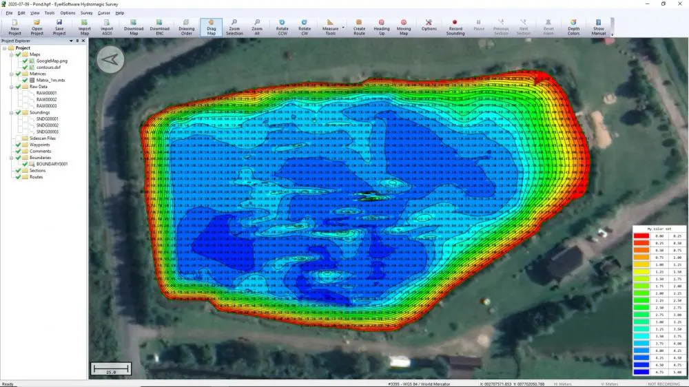
Measurements on and below the water surface
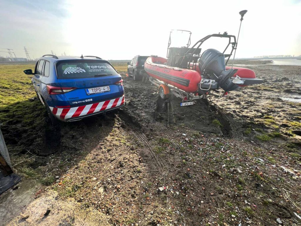
TOPO4D carries out bathymetric surveys on rivers, streams, ditches, ponds, retention basins and other water bodies. For this, we work with specialised equipment such as singlebeam and multibeam sonar, combined with highly accurate positioning via RTK-GNSS.
With this technique, we map the bottom profile, water depths and the course of banks and slopes in detail. This information is essential for dredging works, the construction or maintenance of hydraulic structures such as bridges, locks and quay walls, but also for monitoring erosion processes and ecological development projects.
We process the survey results into clear cross-sections, digital terrain models and maps, ready for further analysis, reporting or integration into spatial and hydraulic models.
How does a bathymetric survey work?
01
Preparation
In advance, we determine the project coordinates and reference heights using RTK-GNSS. This way, all measurements fit perfectly with existing plans, GIS data and design models.
02
Sonar measurements
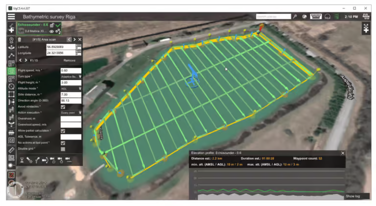
Using a survey boat or specialised measuring setup, we continuously measure the water depth. Depending on the project, we use singlebeam or multibeam sonar, combined with centimetre-accurate GNSS positioning.
03
Processing
The raw survey data is corrected for water level, position and measurement deviations. We then process all points into a reliable digital bottom model.
04
Delivery
You receive the results in the desired format: depth maps, cross-sections, 3D terrain models or CAD and GIS files that can be used immediately within your project.
Accurate data for permits, design and management
Bathymetric surveys are often a mandatory part of permit procedures or serve as the basis for design and management plans. TOPO4D delivers survey data and reports in the format that you, your client or the competent authority requires: clear, correct and ready to use.
Where necessary, we combine bathymetry with traditional land surveys, drone photogrammetry, 3D laser scanning or LiDAR measurements. This creates one integrated and consistent model of the site, with a complete picture above and below the water surface.
They went before you





Why choose bathymetry by TOPO4D?
TOPO4D has the right equipment and experience to survey water bodies safely, efficiently and accurately. Our staff are trained for work on and around water and strictly follow the applicable safety regulations. By combining bathymetry with other survey services, we offer an integrated approach, fully tailored to the needs of your project.
You can count on:
- Accurate surveys of water depths and bottom profiles
- High-resolution sonar and GNSS-based measurements
- Digital terrain models, cross-sections and maps as usable output
- Reporting tailored to governments, engineering firms or contractors
- Combination with other techniques, such as traditional surveying, drone surveys and scanning
Frequently asked questions about bathymetry
How accurate is a bathymetric survey?
By combining sonar with RTK-GNSS, we achieve a very high positioning accuracy. The exact tolerance depends on the project, the water depth and the chosen survey method.
When do you choose singlebeam or multibeam?
Singlebeam is ideal for smaller or linear water bodies. Multibeam is mainly used when a complete and highly detailed bottom surface is needed, such as in harbours or wide waterways.
Which files do I receive after the survey?
Depending on your needs, we deliver DWG, DXF, LandXML, GIS files, point clouds, depth maps and digital terrain models, among others.
Is public bathymetric data already available in Flanders?
Yes, public bathymetric data is available in Flanders. However, it is mainly limited to the North Sea, the Scheldt and navigable waterways, and was primarily collected for nautical management and shipping. For smaller watercourses, ponds, retention basins and private water bodies, there is often no recent or sufficiently detailed dataset.
Why have my own survey carried out if public data already exists?
Public data is mainly focused on large, navigable waters and shipping. Streams, ponds, retention basins, ditches and private waters are rarely surveyed by the government. Moreover, water bottoms change constantly due to siltation, erosion and dredging, while a permit or design requires an up-to-date situation. The resolution of public data is also usually too low for an accurate volume calculation or detailed design.
Request your bathymetric survey or schedule a consultation
Do you have a project on or near the water? Request a no-obligation quote today or schedule a consultation with TOPO4D. We will assess your situation and provide an accurate bathymetric survey, fully tailored to the requirements of your file, design or permit application.
"*" indicates required fields